
When thinking of how a city is built or functions, wayfinding is often not top of mind. But wayfinding is a critical piece of how a person experiences any built environment. Planning and land use decisions shape how people connect to the space they are in, and urban design decisions further shape the street level: what someone will see and experience walking down a street, how they access transit, where they are looking for destinations, and how they move throughout a city.
Designing a Legible City
Wayfinding designers are in a unique position to advocate for the people who will use a space. In a building, this might mean visitors or staff; in a city, this is a much broader group ranging from a first-time visitor to a lifelong resident. Wayfinding and signage layer atop buildings and streets to, ideally, create a legible city that responds to and aids all of these people.
A legible city allows people to build a stronger mental map of their surroundings, giving visitors the confidence and emotional security, while reducing confusion to relax and explore more freely. A successful wayfinding system enhances a visitor’s perception of safety and sense of trust through consistent delivery of information, allowing them to confidently navigate their environment. For example, a visitor to a busy urban area can easily feel overwhelmed or even lost within a cluttered or confusing environment, but seeing a nearby landmark can immediately help them to feel oriented and therefore grounded. Signage further aids orientation, denoting where someone is and directions to nearby destinations. When deployed purposefully, wayfinding provides information when and where people need it through progressive disclosure, which enables someone to find their next destination without overwhelming them with information. In this way, wayfinding creates more welcoming public spaces and contributes to a more equitable city.
Creating Cohesive Journeys
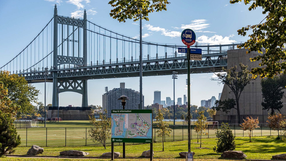
Planning, urban design, architecture, and wayfinding work together to create enjoyable and safe journeys for anyone moving through a city. On Randall’s Island in New York City, our wayfinding system creates a cohesive and clear journey through the island, allowing for both leisurely strolls through the park and purposeful navigation to specific destinations. By providing wayfinding information like maps at clear decision points like bus stops, we provide the information people need when they need it. Color-coding destinations further helps to simplify the mental map a visitor builds, allowing for quick understanding of the area they are in and how to get to where they need to be. Striking placemaking graphics adjacent to the island create a sense of place unique to the area and connect visitors to Randall’s Island.
Taming Transit Chaos
Wayfinding can work hand in hand with architecture to aid in often-chaotic journeys: Penn Station, never an emblem of calm, added a dedicated LIRR entrance along Seventh Ave in 2020. A large canopy is a clear visual indicator to someone on the often-busy nearby sidewalk for where to access the station. Signage beginning on the canopy leads a traveler into the subterranean station and along a central spine to access subways and commuter trains. Visual consistency between Penn Station and the adjacent Moynihan Station helps people navigate a busy environment; even within a single trip, someone can become familiar with the environment if the design encourages this. Placement of digital signage was dispersed along the 33rd Street Concourse so that people could feel confident they would make their train with only the six to eight minutes between track assignment and departure. This approach helped to mitigate congestion towards departing trains. Successful wayfinding systems can create specific paths of travel and information, and in Penn Station, signage creates a corridor that allows fast and confident movement to train platforms.
Integrating Wayfinding for Better Urban Experiences
Wayfinding goes beyond directional signage to actively shape street-level safety, walkability, and user experience. By planning wayfinding early on in a design process, so that visual cues such as landmarks, graphics, and signage are seamlessly integrated into urban form, people moving through a city can have the best possible experience for whatever journey lies ahead.
Photo Credit: Barrett Doherty